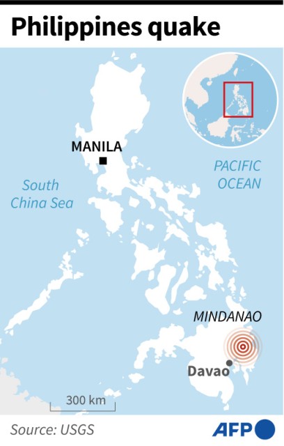
A 6.0-magnitude earthquake rocked the southern Philippines on Wednesday, the US Geological Survey said, with local authorities warning of aftershocks and possible damage.
The shallow quake struck at 6:44 pm (1044 GMT), near Monkayo municipality in Davao de Oro province on Mindanao island.
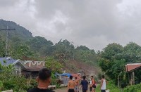
Shallow earthquakes tend to cause more damage than deeper ones, but there were no immediate reports of major damage in the remote and mountainous gold mining region.
Monkayo police Staff Sergeant Harvey Asayas told AFP the quake was strong in the beginning but gradually weakened and stopped after 40 seconds.
“The authorities are now conducting patrols around to assess damage including the fire personnel and disaster officers,” Asayas said.
Police Corporal Edwin Mangigo, who is stationed at an outpost near Mount Diwata in Monkayo, said there had been no reports of casualties at local mining sites.
“We thought there was a landslide because our roof was shaking, we thought it was going to break,” Mangigo said.
Police Corporal Lucita Ambrocio, who is based in the nearby municipality of New Bataan, described the quake as “quick”.
“After 10 minutes, our colleagues went back to the building,” said Ambrocio, who raced outside with her colleagues when the police station started shaking.
“I checked the premises and I saw a small crack in the barracks.”
But in nearby Montevista municipality, Maricar Melgar said the quake was so strong she feared the building she was in would collapse.
“This was probably the strongest earthquake I experienced. My body is still shaking,” the 51-year-old told AFP.
– ‘It was strong’ –
In Tagum city, in Davao del Norte province, about 40 kilometres south west of the epicentre, residents also fled their homes and power was knocked out by the force of the quake.
“We were eating when (the house) began to shake — it was strong,” said Grace Jao, 40.
“We ran outside — we had to take safety measures. We did not see any damage inside the house when we got back.”
Quakes are a daily occurrence in the Philippines, which sits along the Pacific “Ring of Fire”, an arc of intense seismic as well as volcanic activity that stretches from Japan through Southeast Asia and across the Pacific basin.
Most are too weak to be felt by humans, but strong and destructive ones come at random with no technology available to predict when and where it will happen.
The nation’s civil defence office regularly holds drills simulating earthquake scenarios along active fault lines.
The last major quake was in October in the northern Philippines.
The 6.4-magnitude earthquake hit the mountain town of Dolores in Abra province, injuring several people, damaging buildings and cutting power to most of the region.
A 7.0-magnitude quake in mountainous Abra last July triggered landslides and ground fissures, killing 11 people and injuring several hundred.
© Agence France-Presse


