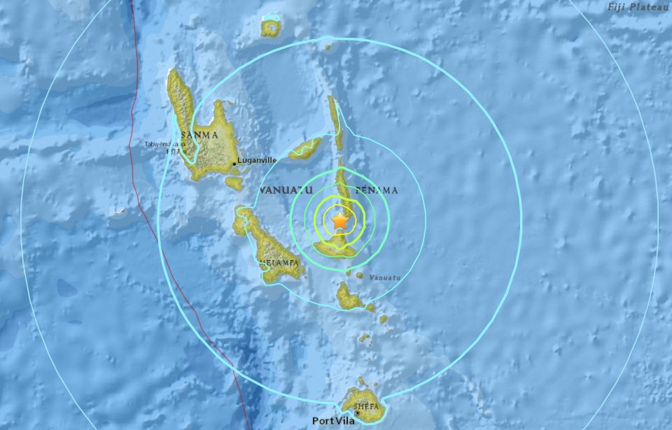
A 6.7-magnitude earthquake hit the Pacific island nation of Vanuatu on Wednesday morning, the US Geological Survey said, but no tsunami warning was issued.
The quake struck at a moderate depth of 30 kilometres (19 miles) with the epicentre just off the northern tip of Vanuatu’s sparsely-populated Ambrym island.
The Pacific Tsunami Warning Center said there was no tsunami risk.
“Shaking would have been felt throughout the whole of Vanuatu,” Geoscience Australia senior seismologist Eddie Leask told AFP.
“But it’s hard to tell whether it will cause damage. It’s reasonably shallow but it all depends on the buildings, soil type and so on.”
On its website, Geoscience put the potential damage radius at 63 kilometres.
The nearest city, Lakatoro, is 78 kilometres away, with the capital Port Vila 187 kilometres north of the epicentre.
“We get a lot of five and six magnitude quakes coming through Vanuatu,” added Leask.
“We’d expect to see smaller aftershocks, and even a bigger one.”
The Vanuatu Disaster Management Office told AFP it was not aware of any immediate damage.
Vanuatu, with a population of about 280,000 spread over 65 inhabited islands, is regarded as one of the world’s most disaster-prone countries.
It sits on the so-called “Pacific Ring of Fire,” making it vulnerable to strong earthquakes and volcanic eruptions, while powerful cyclones also regularly lash the islands.
A 7.0-magnitude quake struck in 2017, but no damage was reported.
© Agence France-Presse


