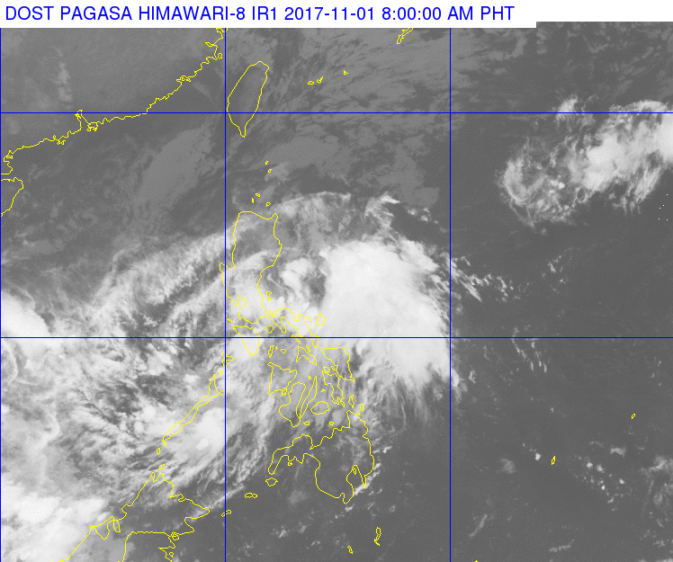
(Eagle News) – The low pressure area southwest of Masbate City has developed into a tropical depression and was named “Ramil,” prompting the Philippine Atmospheric, Geophysical and Services Administration to place Metro Manila, Bicol, CALABARZON and MIMAROPA under signal number 1.
The country’s weather bureau forecast the estimated amount of rainfall from “moderate to occasionally heavy rains within the 200 kilometer diameter of the tropical depression.”
It has maximum sustained winds of 45 kilometers per hour near the center and gustiness of up to 60 kph.
As of 8 a.m., TD Ramil has maintained its strength and is expected to traverse the Calamian Group of Island today, according to PAGASA’s latest bulletin.
It said sea travel would be risky over the seaboards of Northern Luzon and the eastern seaboard of Southern Luzon.
PAGASA further advised residents in Metro Manila, CALABARZON, and the rest of MIMAROPA to be “alerted against possible flashfloods and landslides.”
As of 7 a.m. today, the center of tropical depression “Ramil” was estimated at 100 kilometers east of Coron, Palawan.
“Ramil” is forecast to move west at 20 kph, and will be 310 kilometers west of Coron, Palawan by tomorrow (Thursday) morning.
It is forecast to be outside of the Philippine Area of Responsibility (PAR) by Friday morning.
(Eagle News Service)


