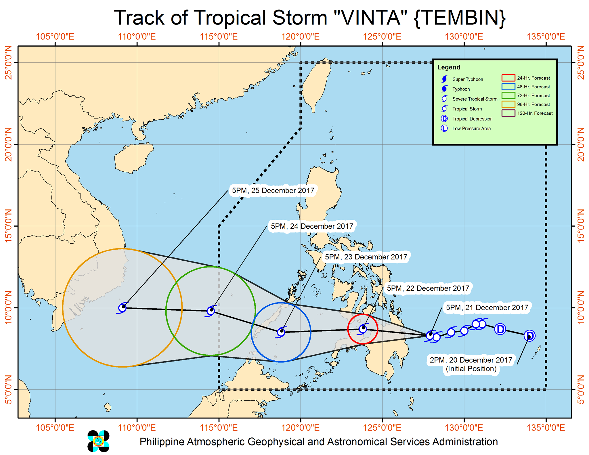
(Eagle News) — Tropical Storm “Vinta” slightly intensified on Thursday night, and is now threatening the Caraga area.
In its 8 p.m. bulletin, the Philippine Atmospheric Geophysical and Astronomical Services Administration said the center of the tropical storm was seen 130 kilometers east of Hinatuan, Surigao del Sur as of 7 p.m.
“Vinta” is packing maximum sustained winds of 85 kilometers per hour near the center and gustiness of up to 120 kilometers per hour, and is forecast to move west at 19 kilometers per hour.
It is expected to make landfall over Surigao del Sur between late this evening and tomorrow early morning.
Signal No. 2 has been hoisted over Siquijor and Southern Negros Oriental, Surigao del Norte including Siargao Islands, Surigao del Sur, Agusan del Norte, Agusan del Sur, Northern Davao Oriental, Compostela Valley, Davao del Norte, Bukidnon, Misamis Oriental, Camiguin, Northern Zamboanga del Norte, Lanao del Norte, and Lanao del Sur.
Southern Leyte, Southern Cebu, Bohol, Southern Negros Occidental Dinagat Island, Misamis Occidental, North Cotabato, Maguindanao, the rest of Davao Oriental, Davao del Sur, Zamboanga del Sur, Zamboanga Sibugay, and the rest of Zamboanga del Norte are under Signal No. 1.
Scattered to widespread moderate to heavy rains are expected over Central Visayas, Eastern Visayas, Caraga, Davao Region, Northern Mindanao, and Zamboanga Peninsula within 24 hours, PAGASA said.
It added that residents of these areas must “take appropriate actions against possible flooding and landslides, coordinate with their respective local disaster risk reduction and management offices, and continue monitoring for updates.”
PAGASA added that sea travel was “risky over the seaboards of areas under a tropical cyclone warning signal.”


