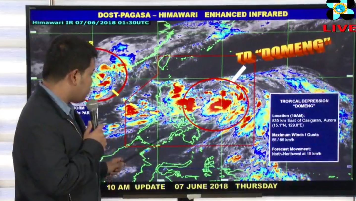
(Eagle News) — The combined effects of “Domeng” and the monsoon trough are expected to bring moderate to occasional heavy rains over Southern Luzon and Visayas, the Philippine Atmospheric Geophysical and Astronomical Services Administration said on Thursday, June 7.
According to PAGASA, while landfall remains less likely to occur, the tropical depression is expected to enhance the southwest monsoon, which will result in moderate to heavy monsoon rains over Mimaropa and Western Visayas, “with gradual northward progression of monsoon rains towards the rest of the western section of Luzon, including Metro Manila, during the weekend.”
In its 11 a.m. update, PAGASA said “Domeng” was so far located 835 kilometers east of Casiguran, Aurora, and is packing maximum sustained winds 55 kilometers per hour near the center, and gustiness of up to 65 kilometers per hour.
The tropical depression is moving north northwest at 15 kilometers per hour.
“Domeng” is expected to leave the Philippine Area of Responsibility on Sunday.
Ewiniar
PAGASA said it was also monitoring another storm.
“Ewiniar,” it said, was located 1075 kilometers west of Basco, Batanes, packing maximum sustained winds of 65 kilometers per hour near the center, and gustiness of up to 80 kilometers per hour.
So far, though, PAGASA said “Ewiniar” was outside PAR.
The agency said there is a “minimal” chance the weather disturbance will affect the country.


