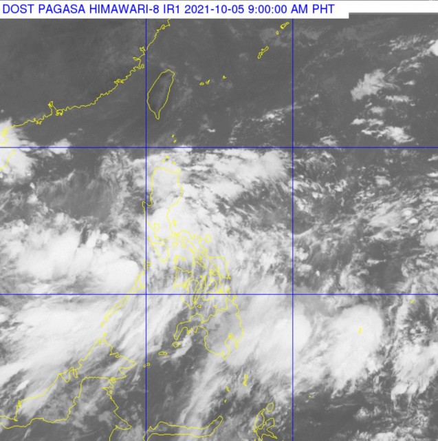
Lannie forecast to exit PHL on Wednesday, Oct. 6

(Eagle News) – Tropical depression Lannie has “crossed the northern portion of Palawan and is over El Nido bay where it recently made landfall. So far, only these areas in Palawan including the Calamian Islands are under tropical cyclone wind signal, according to PAGASA.
In its 8 a.m. update on Tuesday, Oct. 5, PAGASA said that Lannie had made landfall in two areas in Palawan over the last three hours. These are in Iloc Islands Linapacan, Palawan (6:15 AM); El Nido, Palawan at 6:45 a.m.
As of 7 a.m., the center of Tropical Depression “LANNIE” was estimated over the coastal waters of El Nido, Palawan (11.3°N, 119.4°E) with maximum sustained winds of 45 km/h near the center, gustiness of up to 55 km/h.
It is moving northwestward at 25 km/h and its strong winds extend outwards up to 130 km from the center
-Forecast track for Wednesday, Oct. 6-
The tropical depression is “forecast to continue tracking northwestward and west northwestward over the West Philippine Sea away from the country until tomorrow” Wednesday, Oct. 6.
“On the forecast track, it will likely exit the Philippine Area of Responsibility (PAR) tomorrow afternoon or evening,” PAGASA said.
Once outside PAR, Lannie is forecast to turn north northwestward 1towards southern mainland China or Hainan Island.
-Moderate to heavy rains –
Today, Tuesday, Oct. 5, moderate to heavy rains are likely over Palawan including Calamian, Kalayaan, and Cuyo Islands.
Light to moderate with at times heavy rains are also possible over Cordillera Administrative Region, Cagayan Valley, Central Luzon, Metro Manila, CALABARZON, Bicol Region, Western Visayas, and the rest of MIMAROPA.
PAGASA said that under these conditions, isolated to scattered flooding (including flash floods) and rain-induced landslides are likely especially in areas that are highly or very highly susceptible to these hazard as identified in hazard maps
“The enhanced easterly flow north and southwesterly flow south of the tropical depression may also bring occasionally gusts reaching near gale to at times gale-force in strength over extreme Northern Luzon and the coastal and upland/mountainous areas of Cordillera Administrative Region, mainland Cagayan Valley, Ilocos Norte, Central Luzon, CALABARZON, MIMAROPA, Bicol Region, Western Visayas, Zamboanga Peninsula, and Bangsamoro in the next 24 hours,” according to PAGASA.
-Lannie forecast to intensify into a tropical storm by tomorrow-
“Lannie” will likely remain a tropical depression today, the weather bureau said, but added that this could “intensify into a tropical storm tomorrow morning” as it nears PAR or the country’s border.
Once outside PAR, it could further intensify as it moves towards southern China
Slight improvement in environmental conditions will allow it to intensify into a tropical storm tomorrow morning as it nears the border of the PAR. Further intensification is possible as the cyclone moves towards southern China.
(Eagle News Service)


