PAGASA says super typhoon “Hinnamnor” to be given domestic name “Henry” once it enters PHL; Another tropical depression, “Gardo,” already inside PHL

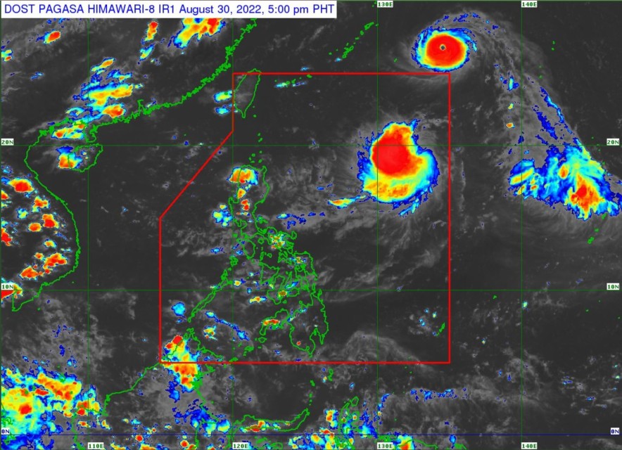
(Eagle News) – The typhoon east northeast of extreme northern Luzon has developed into a super typhoon named “Hinnamnor” with maximum sustained winds of 185 kilometers per hour near the center and gusts of up to 230 km per hour.
According to the country’s weather bureau PAGASA, the center of the typhoon was at 1,665 kilometers east northeast of extreme northern Luzon as of 10 a. m. on Tuesday, August 30. It is still outside the Philippine Area of Responsibility (PAR). As pf 2 p.m., it became a super typhoon.
PAGASA said that another LPA that has earlier entered the country became a tropical depression and was named “Gardo.” But Gardo only has maximum sustained winds of 55 kilometers per hour and gusts of up to 70 km/h. Compare this to typhoon “Hinnamnor” that has up to 230 kilometers of gusts.
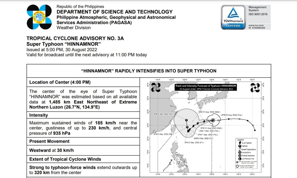
As of 4 p.m., the center of the eye of Super Typhoon “HINNAMNOR” was estimated based on all available data at 1,485 km East Northeast of Extreme Northern Luzon (26.7°N, 134.9°E), according to PAGASA’s tropical cyclone advisory no. 3A issued at 5 p.m. Tuesday, August 30.
The supertyphoon is moving westward at 30 km per hour, and its typhoon-force winds “extend outwards up to 320 km from the center.”
PAGASA weather forecaster Samuel Duran told Eagle News that these two weather disturbances — tropical depression “Gardo” and super typhoon Hinnamnor — are not expected to make landfall in the Philippines.
Super typhoon with the international name “Hinnamnor” is much more powerful, and might enhance the southwest monsoon.
Grace Castañeda, another PAGASA weather forecaster, told Eagle News that there is also a possibility that super typhoon “Hinnamnor” once it enters the country, would pull in or engulf tropical depression “Gardo” making itself more expansive.
“Mas magiging malaki po ito kapag nahigop si Gardo,” she said.
But because of its distance, it will only affect extreme northern Luzon, she said.

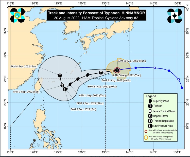
PAGASA said that the super typhoon “will move generally westward today over the sea south of Japan, then turn westsouthwestward tomorrow (31 August) while decelerating over the sea southeast of the Ryukyu Islands.”
It is forecast to enter the country on Wednesday evening, August 31 and will be given the name “Henry” once it enters PAR.

“Once inside the PAR, the domestic name ‘HENRY’ will be assigned to this tropical cyclone. Further deceleration is forecast to occur as it turns more southwestward over the northern Philippine Sea,” PAGASA said in its 5 p.m. bulletin.
By Friday, September 2, to Saturday, September 3, “Hinnamnor” may become almost stationary.
Hinnamnor intensified into Super Typhoon at 2 p.m. Tuesday, August 30.
“This tropical cyclone may continue to intensify over the sea south of Japan and may reach a peak intensity of 195 km/h,” PAGASA said.
The extent of tropical cyclone winds of “HINNAMNOR” may continue to expand in the coming days as it moves towards the northern Philippine Sea, it said.
“As such, the possibility of hoisting a Tropical Cyclone Wind Signal over Extreme Northern Luzon during the occurrence of this tropical cyclone within the PAR region is not ruled out. This tropical cyclone may bring rough seas over the northern and eastern seaboard of Luzon beginning late Thursday
(1 September) or early Friday. Such condition may be risky for those using small seacrafts. Mariners are advised to continue monitoring for updates, PAGASA added.
(Eagle News Service)


