– AFP / AFP / GAL ROMA
Australia’s weather bureau confirmed on Tuesday that an El Nino weather pattern is under way, bringing hot and dry conditions that risk a severe wildfire season and drought.
The announcement, which follows similar confirmations from other weather agencies, came as the country bakes in unseasonal heat, with the weather agency warning of more to come.
Government forecaster Karl Braganza said elevated surface temperatures in the Pacific Ocean could impact the country until early next year.
“This summer will be hotter than average, and certainly hotter than the last three years,” he said.
“Importantly with the El Nino now settling into that pattern in the Pacific Ocean, that increases our confidence that this pattern is going to last until the end of summer,” he added.
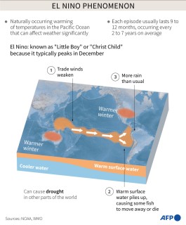
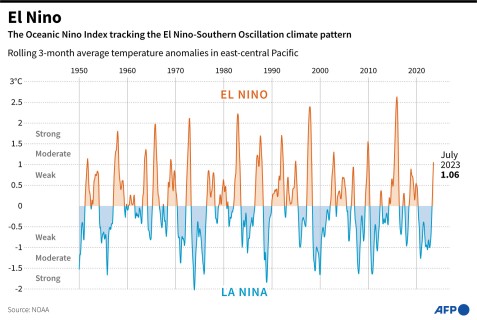
The El Nino climate pattern occurs on average every two to seven years and usually lasts between nine to 12 months.
In July, the UN’s World Meteorological Organization declared El Nino was already under way and said there was a 90-percent chance that it would continue during the second half of 2023.

El Nino is typically associated with warming ocean surface temperatures in the central and eastern tropical Pacific Ocean.
It can bring severe droughts to Australia, Indonesia and other parts of southern Asia, coupled with increased rainfall in parts of southern South America, the southern United States, the Horn of Africa and central Asia.
The relationship between El Nino and climate change is not well understood.
But Australia’s government science agency earlier this year concluded that climbing global temperatures may increase both the likelihood of the pattern forming, and the severity of its impacts.
– Warning of ‘extremes’ –
Record-high global sea surface temperatures played a major role in stoking soaring temperatures throughout the Northern Hemisphere summer, with marine heatwaves hitting the North Atlantic and the Mediterranean Sea.
Braganza said the onset of El Nino in the Pacific would continue to inject heat into the planet’s oceans.
Australian climate researcher Nandini Ramesh said this year’s El Nino was “developing during some of the warmest global average temperatures in history”.
Worldwide, temperature records have tumbled in recent years, as climate change makes meteorological conditions more volatile.
July 2023, marked by heatwaves and fires around the world, was the hottest month ever registered on Earth, according to the European Union’s climate observatory Copernicus.
Climate scientist Andrew King said El Nino would escalate the risk of bushfires and sudden droughts in parts of Australia.
“The unusually hot weather we’re seeing across southeast Australia at the moment is a warning of the kind of extremes we’re likely to see more of over the next few months.”
The El Nino pattern has formed after consecutive years of La Nina, which typically brings cooler conditions and more rain to Australia.
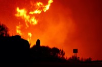
Australia is facing its most intense bushfire season since the “Black Summer” of 2019-2020, when a series of out-of-control infernos raged across the eastern seaboard.
There are fears that unusually wet conditions since then have accelerated forest growth, increasing the amount of potential fuel for bushfires


