QUEZON CITY, July 5 (PIA) — The new executive director of the National Disaster Risk Reduction Council Ricardo Jalad emphasized to the public the need to prepare for the possible consequences of the southwest monsoon (habagat) that would bring frequent rains affecting Southern Luzon and Visayas.
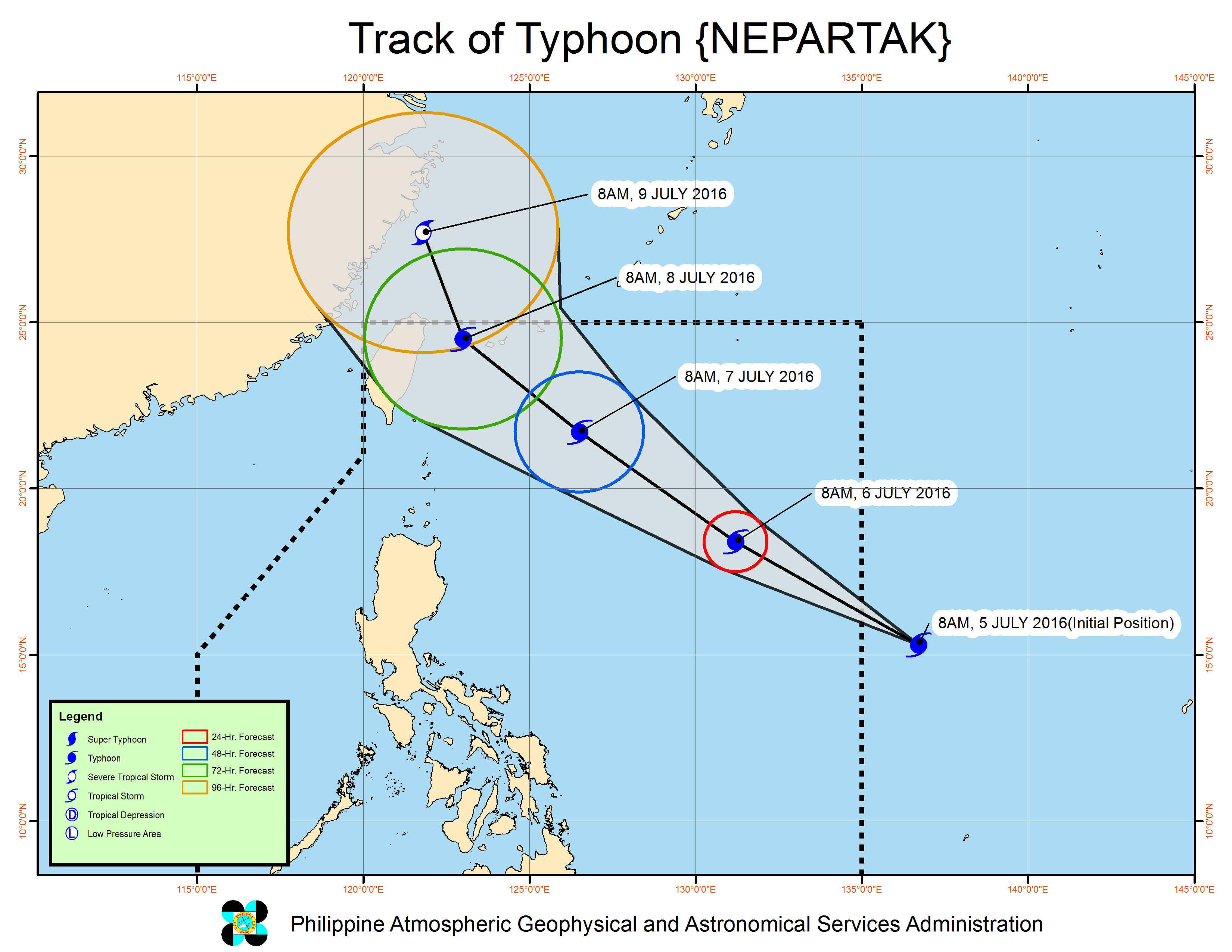
This he stressed after holding his first Pre-Disaster Risk Assessment with the council’s core members yesterday to prepare for the possible risks of Tropical Storm NEPARTAK (Butchoy) that will enter the Philippine Area of Responsibility this afternoon.
Experts from PAGASA reported that while the said storm won’t make landfall in the Philippines, floods and landslides are still expected over the provinces of Bataan, Zambales and Pangasinan due to habagat
The Department of Interior and Local Government has issued a La Nina advisory to all provincial governors, city and municipal mayors, and DILG regional directors.
Local government units were encouraged to immediately convene their Local Disaster Risk Reduction Management Council as the need be and closely coordinate with PAGASA for timely weather updates and with the Department of Environment and Natural Resources- Mines and Geoscience Bureau (DENR-MGB) for adequate information on the threat of flooding and landslides.
The Department of Social Welfare and Development (DSWD) has prepared its 18 regional warehouses maintaining 30,000 family food packs ready for prepositioning at the LGU.
It has also built eight pilot evacuation center cum multi-purpose building in 6 regions (2,3,4A,5, 6, and CARAGA). A center is being built in Region 1 while another center is yet to be built in Region 8.
The NDRRMC will raise its alert level into blue effective 3PM today.
At 10:00 AM today, the Philippine Atmospheric Geophysical and Astronomical Services Administration has recorded that the eye of Typhoon “BUTCHOY” was located based on all available data at at 1,570 km East of Baler, Aurora (OUTSIDE PAR) (15.6, 136.2).
Strength : Maximum winds of 120 kph near the center and gustiness of up to 150 kph.
Forecast movement : Forecast to move Northwest at 30 kph
Forecast position :
• 24 Hour(Tomorrow morning): 1,010 km East of Aparri, Cagayan
• 48 Hour(Thursday morning): 495 km East Northeast of Itbayat, Batanes
• 72 Hour(Friday morning): 435 km North Northeast of Itbayat, Batanes
• 96 Hour(Saturday morning): 775 km North of Itbayat, Batanes (OUTSIDE PAR
Estimated rainfall amount is from moderate to heavy within the 300 km diameter of the typhoon. (FGM-PIA) (PAG-ASA)


