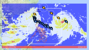
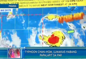
(Eagle News) — While storm “Egay” has already left the country, PAGASA is monitoring two new weather disturbances which are still outside the Philippine Area of Responsibility (PAR), but which could enter the country anytime this week.
One of these is typhoon “Chan-Hom” (international name) which has maximum strong winds of 120 kilometers per hour near the center and gustiness of up to 150 kph. It is forecast to move west northwest at 20 kph.
This typhoon is expected to enter the country Tuesday evening (July 7), and will be renamed “Falcon” if it enters the country. By Wednesday morning, it is expected to be at 1190 km east of Itbayat, Batanes and at 780 km east northeast of Itbayat, Batanes by Thursday morning. By Friday morning, it is expected to be at 600 km northeast of Itbayat, Batanes or outside the PAR.

Aside from typhoon “Chan-Hom”, PAGASA is also on the lookout for another tropical storm with the international name Nangka.
This is stronger than typhoon Chan-Hom, since it has maximum sustained winds of 150 kph and gustiness of up to 185 kph, according to PAGASA.
This weather disturbance will be renamed “Guring” once it enters the Philippine Area of Responsibility.


