JAKARTA, Indonesia (AFP) — A plan to use satellite imagery and aerial mapping to protect Indonesia’s peatlands — a vast carbon sink and source of much of the country’s greenhouse emissions — was awarded a $1 million prize on Friday.
The cutting-edge technology will be used by authorities to clamp down on illegal clearance of the land for plantations, helping to prevent a repeat of annual forest fires that plague the region while also reducing the country’s carbon footprint.
The government, with the support of international partners, came up with the idea of a competition two years ago to help achieve its commitments under the Paris Agreement on climate change.
The winning entry from the International Peat Mapping Team was recognised by the judges for offering “the most accurate, timely and cost-effective methodology for mapping peatlands”.
Bambang Setiadi, an Indonesian member of the winning team, told reporters that Indonesia has the largest tropical peatland area in the world.
“We need technology to measure the depth of peat domes and water levels,” said Setiadi, whose team also included scientists from Indonesia, Germany and the Netherlands.
Peatlands are fragile ecosystems formed over thousands of years by the accumulation of dense wet plant material.
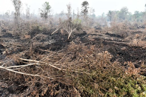
When drained or cleared by fire to make way for commercial plantations, such as for palm oil or pulpwood, the carbon is released into the atmosphere.
In 2015, Indonesia experienced its most serious fires in some years, worsened by dry weather caused by an El Nino phenomenon, and cloaked large stretches of Southeast Asia in choking smog for weeks.
A moratorium on conversions of new peatlands was established in 2011 to improve management and reduce fires.
But poor spatial data and overlapping forestry maps are a major hindrance for authorities trying to enforce regulations governing them.
Indonesia’s geospatial agency, which oversaw the internationally funded competition, said the new mapping technology would be deployed this year.
The winning technology combines satellite and aerial LiDAR mapping with on-the-ground measurements to find the depth and extent of wetlands and peat bogs.
© Agence France-Presse


