


SEVERE WEATHER BULLETIN No. 12
FOR: TROPICAL DEPRESSION “#ChedengPH”
TROPICAL CYCLONE: WARNING
ISSUED AT 11:00 AM, 05 APRIL 2015
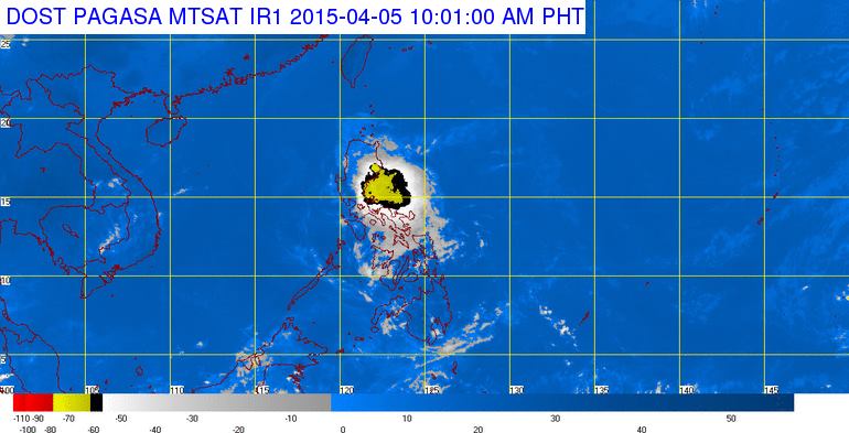
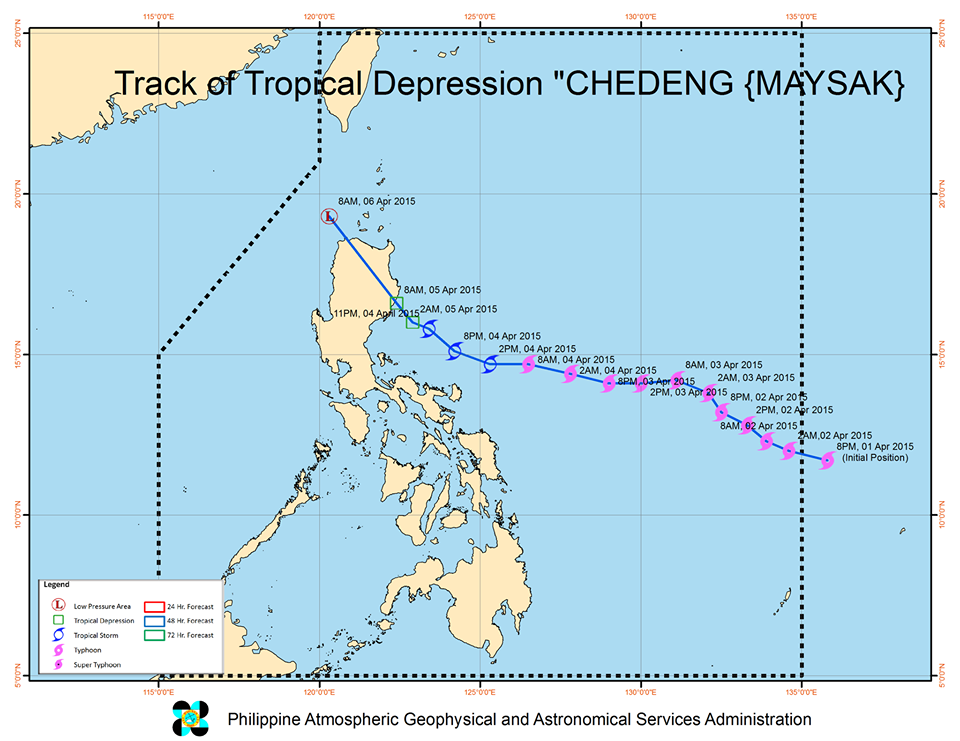
“CHEDENG” IS NOW TRAVERSING ISABELA PROVINCE.
• Estimated rainfall amount is from light to moderate within the 75 km radius of the tropical depression.
• It is expected to weaken into a Low Pressure Area within 24 hours.
• Fisher folks are advised not to venture out over the northern seaboard of Luzon and eastern seaboard of Southern Luzon.
• Public Storm warning signals elsewhere are now lowered.
Location of eye/center: At 10:00 AM today, the center of Tropical Depression “CHEDENG” is now over Palanan, Isabela. (17.0°N, 122.2°E).
Strength: Maximum winds of 55 kph near the center
Forecast Movement: Forecast to move Northwest at 13kph
Forecast Positions:
• 24 hour (Tomorrow morning): 125 km North – Northwest of Laoag City
Public Storm Warning Signal 1
(Winds of 30-60 kph is expected in at least 36 hrs)
#Kalinga, #Isabela, #Ifugao, #MountainProvince
• Twigs and branches of trees maybe broken
• Some banana plants may tilt or land flat on the ground
• Rice in flowering stage may suffer significant damage
• Some nipa and cogon houses maybe partially unroofed
• Sea travel of small sea crafts and fishing boats is risky
These areas will have occasional rains with occasional gusty winds.
The public and the disaster risk reduction and management council concerned are advised to take appropriate actions and watch for the next bulletin to be issued at 5 PM today.
PAGASA-DOST


