
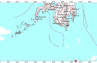

(Eagle News) — Signal No. 2 is raised over parts of Visayas and Mindanao as Tropical Storm “Auring” maintained its strength and moved west-northwest.
The Philippine Atmospheric Geophysical and Astronomical Services Administration said under the tropical cyclone wind signal are the southern portion of Eastern Samar (San Julian, Borongan City, Maydolong, Balangkayan, Balangiga, Lawaan, Llorente, Hernani, General Macarthur, Quinapondan, Giporlos, Salcedo, Mercedes, Guiuan) and Dinagat Islands and the northern portion of Surigao del Norte (Surigao City, Sison, Tagana-An, Placer, San Francisco) including Siargao and Bucas Grande Islands, with “Auring” situated 395 km east of Hinatuan, Surigao del Sur.
It is packing maximum sustained winds of 65 kph near the center and gustiness of up to 80 kph.
Under Signal No. 1 are Sorsogon, mainland Masbate, and Ticao Island in Luzon; Northern Samar, the rest of Eastern Samar, Samar, Biliran, Leyte, Southern Leyte, Cebu, Bohol, Siquijor, Negros Oriental, the northern and central portions of Negros Occidental (Kabankalan City, Himamaylan City, Binalbagan, Isabela, Moises Padilla, Hinigaran, La Castellana, Pontevedra, San Enrique, La Carlota City, Pulupandan, Valladolid, Bago City, Murcia, Bacolod City, Talisay City, Silay City, Enrique B. Magalona, Victorias City, Manapla, Cadiz City, Sagay City, Escalante City, Toboso, Calatrava, San Carlos City, Salvador Benedicto), the eastern portion of Iloilo (Barotac Viejo, Lemery, San Rafael, Sara, Ajuy, Concepcion, San Dionisio, Batad, Estancia, Balasan, Carles), and the eastern portion of Capiz (Dumarao, Cuartero, Ma-Ayon, Pontevedra, Panay, President Roxas, Pilar) in VIsayas; and the rest of Surigao del Norte, Surigao del Sur, Agusan del Norte, Agusan del Sur, Davao Oriental, Davao de Oro, Davao del Norte, Davao City, Camiguin, Misamis Oriental, and Bukidnon in Mindanao.
In the next 24 hours, the combined effects of the surge of the northeast monsoon and the tropical storm will bring gale-force winds to areas under Signal No. 2, and strong breeze to near-gale conditions with occasionally higher gusts over the areas where Signal No. 1 is in effect, and over CALABARZON, MIMAROPA, Aurora, and the rest of Visayas and Bicol Region.
PAGASA said in the next 24 hours, rough to very rough seas will be experienced over the seaboards of areas under a tropical cyclone wind signal, and the eastern seaboard of Luzon not under a storm signal.
Rough seas will prevail over the southern seaboard of Luzon (including the eastern seaboard of Palawan), the remaining seaboards of Visayas, and the northern, eastern, and western seaboards of Mindanao that are not under any storm signal.
Sea travel is risky for all types of sea vessels over these waters.
Moderate to rough seas will be experienced over the remaining seaboards of the country.
Tropical Storm “Auring” is forecast to continue moving generally west-northwestward to northwestward in the next 48 hours, and may initially make landfall over the Dinagat Islands-Eastern Samar (southern portion including Homonhon Island)-Leyte area between tonight or tomorrow early morning.


