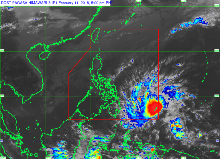
(Eagle News)– The tropical depression outside the Philippine Area of Responsibility has intensified into a tropical storm and is expected to enter PAR on Sunday night.
The Philippine Atmospheric Geophysical and Astronomical Services Administration said that as of 4:00 p.m., the center of tropical storm with international name “Sanba” was 1,035 kilometers east of Hinatuan, Surigao del Sur.
The weather disturbance is packing sustained winds of 65 kilometers per hour near the center and gustiness of up to 80 kph, and is forecast to move west northwest at 27 kph.
Once it enters PAR, it will be named “Basyang.”
Signal No. 1 has been hoisted over Dinagat Islands, Surigao del Norte, Surigao del Sur, and Davao Oriental.
PAGASA said scattered to widespread moderate to heavy rains will prevail over the eastern section of Visayas and of Mindanao beginning tomorrow.
“Residents in these areas must continue monitoring for updates, undertake precautionary measures against possible flooding and landslides, and coordinate with their respective local disaster risk reduction and management offices,” the weather bureau said.
It added that fisherfolk and those with small seacraft are “advised not to venture out over the eastern seaboard of Visayas and of Mindanao due to expected rough to very rough seas associated with the approaching tropical storm.”


